Docklands Light Railway : Routes : Isle of Dogs map
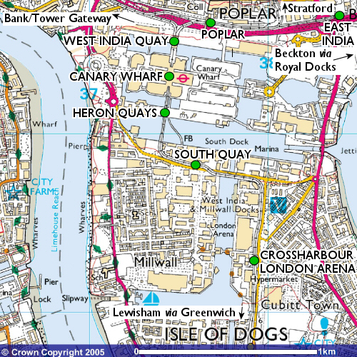 |
This map shows the route the DLR takes through the Isle of Dogs, the core of the network. | |
| Copyright: | Image produced from the Ordnance Survey Get-a-map service. Image reproduced with kind permission of Ordnance Survey and Ordnance Survey of Northern Ireland. Original map image and map data ©Crown Copyright 2005; alterations and additions © Peter Courtenay 2005. | |
[copyright statement] [terms & conditions] [trespass & safety policy] [privacy]
TheTrams.co.uk is not associated with any transport operator or authority
All content © Peter Courtenay 2004–2024 except where otherwise stated


Page generated in ≈ 0.0025 seconds